
A Brief History of Landrake
The Parish of Landrake with St.Erney lies in the south east corner of Cornwall. Its location is commanding with the parish church visible for miles around.
The parish boundary is delineated to the east by the River Lynher as far north as the west-east stream joining the Lynher at Coombe Cottage; to the north by this same stream from Coombe Cottages to Blunts; to the west from Blunts in a generally SSE direction to the River Tiddy just east of Morval Quay, and from there to where the Tiddy and the Lynher meet.
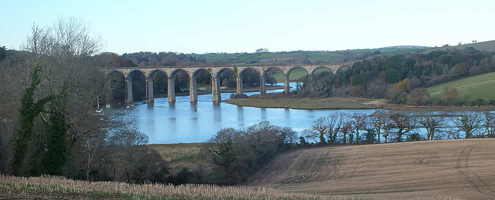
The parish has two distinct geographical parts. The southern part, which is largely St.Erney, is bounded by tidal rivers on both east and west as far as Notter and Tideford where bridges were built before or during the 16 th century. The northern part is not so accessible and is quite hilly in parts. Here, both the rivers are flooded valleys which have been silted up over the years producing an area of salt marsh.
Evidence of settlement in prehistoric times in the parish is scarce, although a number of archaeological finds such as worked flints and a spindle whorl were found near St.Erney with a possible dating of Neolithic and Iron Age. Both local field names and some place names suggest the area may have once had rounds or hillforts.
The earliest known written record of this parish comes in the 1018 Charter when King Cnut confirmed the gift of land in Landrake and St.Erney to Bishop Burwhold by King Edmund in exchange for some land in Devon. This Charter is not clear as to the boundaries involved but the names of Poldrisoc, (Poldrissick) Aelmarches wylle (Markwell) and Bryhter (Brightor) are mentioned, while others, such as horsewell, pyrlestan (meaning a 'holed stone'), bot frysc ('dwelling') are difficult to locate with accuracy.
After Bishop Burwhold died, these lands passed to the Priory of St.Germans and remained with them until the Dissolution of the Monasteries by Henry VIII in 1539. It was said that the Manor of Landrake was one of the most valuable in the county in 1272.
Since the Dissolution, the Priory lands were sold and over the years have been in the hands of the Eliots (of St.Germans), the Hobarts (who later became the Edgcumbes by marriage) and also the Carew-Poles (of Antony). Over the last century, this land has been divided into smaller areas and sold.
Industry today in the parish involves only a few people but over the centuries farming and quarrying involved many. Tartan Down Quarry in the northern part of the parish has produced a special volcanic type of stone which was ideal for buildings. In fact the church of St.Germans Priory was built of this 'Tartan Down Stone', likewise our own parish church of St.Michaels. The width of West Lane suggests that this was an important routeway to take the stone in wagons from the quarry to the main road. Beside the River Lynher there were a number of quarries, Driller's being one of the oldest (18th century) producing stone for nearby Plymouth and Devonport. An easy routeway from those quarries was down the river linking up with the River Tamar to Devonport .On the return journey, instead of being empty of cargo, the barges would carry either limestone from the Cattedown and Plymstock Quarries or 'Devonport Dung', ie. the sweepings from the streets of Devonport where horse manure provided a worthwhile fertiliser! Alongside both the River Lynher and Tiddy you can still find the old quays where these barges plied their trade. Several people have found coins and interesting artefacts such as small bottles and broken pipes around the farms in the parish which had been swept up from the streets of Devonport and spread over the fields of Landrake.
The soils in Cornwall are highly acidic and as such, poor for many aspects of agriculture, thus the 'liming' of fields helped to make the soils more fertile and productive. Lime was produced by placing alternate layers of coal and limestone in a lime kiln from the top of the structure. A coal or wood fire at the base charged the contents - the final product, quicklime, being extracted from the base of the kiln after two or three days. Quicklime was also used to make mortar for building purposes. Many of these limekilns were situated beside the river. A good example can still be seen at Poldrissick. Beside this Poldrissick Quay can also be seen the remains of one of the old Tamar barges sunk in the mud. This was built in 1870 and called the Millom Castle. It was used to carry the stone from those quarries. A second barge called the Lynher, that had lain at Poldrissick, having been built at the local boatyard at Calstock, was dug out of the mud a few years ago and has been restored to its former glory.
Cider and beer were made locally. Poldrissick farm has a complete cider mill and also a cider press. Lower Cuttivett and Markwell also have their original cider mills. In 1840 Landrake had 135 acres of orchards and gardens and it is believed that some illicit spirits were being produced. Perhaps this was the 'Landrake Dew' which was made from cider and also known as 'Farmers' Gin'. There were two inns in the village at that time, the Old Inn - which was where the Manor House is today, and the New Inn, which later became the Buller's Arms. Around the village square there were a number of shops and craftsmen; grocers, bakers, butchers, drapers, tailors, saddlers, smiths, wheelwrights, shoe and clog makers, carpenters and masons.